We’ve been hard at work poring over maps studying our route for the summer. Our goal is to hike a High Sierra Loop that will take us through some of the most spectacular country that the range has to offer. Half of this loop will be on trail, following the John Muir Trail (JMT) for a significant portion. The second half will be mostly cross-country in even higher sub-alpine and alpine terrain follow a route pioneered by Steve Roper called the Sierra High Route (SHR).
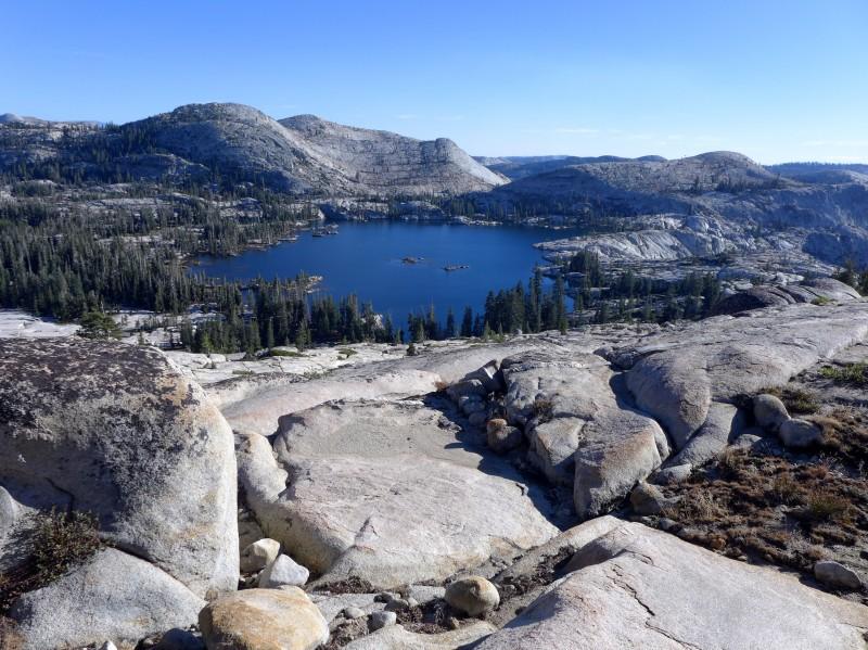
Big Lake in the Emigrant Wilderness (Photo 2013)
We’ll begin our hike at the Crabtree Meadow trailhead on the western slope of the Sierra. From there we will hike across the range to the east until we join the PCT in the Yosemite Hinderlands. The Hinterlands span some of our favorite places in the High Sierra. This is the land of great canyons. Matterhorn Canyon, in particular, rivals Yosemite Valley and is a majestic look into what Yosemite Valley must have been like when it was still a remote, wilderness location.
The Enchanted Dish, Yosemite Hinterlands (Photo 2005)
Our first resupply will be in Tuolumne Meadows, Yosemite’s outpost for high country travelers. Backpackers love Tuolumne Meadows because the area seems purpose built for supplying and resupplying backpackers. There’s a grill, post office, store and showers. What more could one need?
From Tuolumne, it’s south on the JMT past the Ritter Range, through Devil’s Postpile, a little stop at Iva Bell Hot Springs and them on to Vermillion Valley for our second resupply. In 2008 Melody and I looked at the Vermillion Valley Resort (VVR) as a location for our wedding (but decided on Mono Hot Springs, down the road) so it will be exciting to be in this area again.
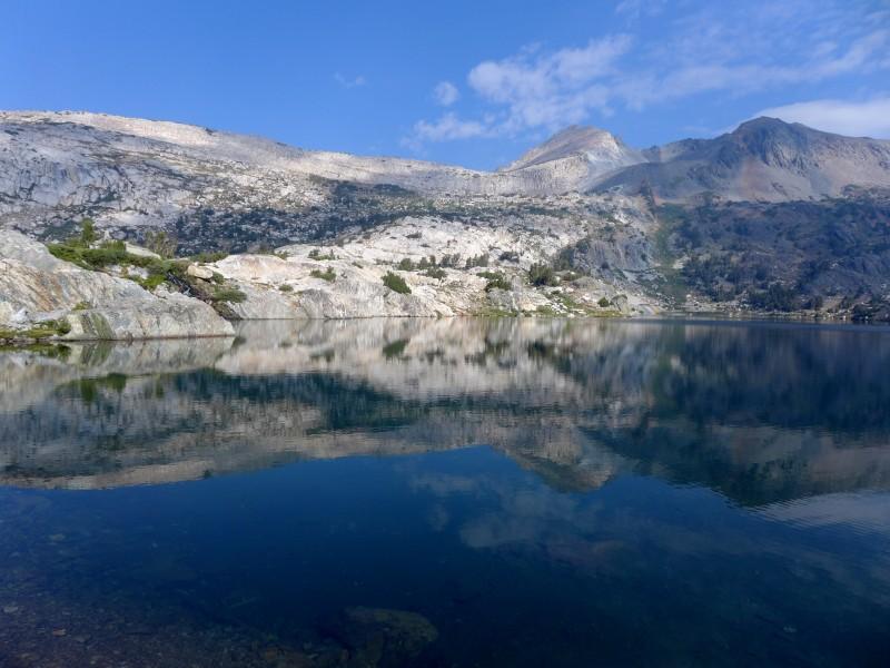
From VVR we’ll climb in to higher and higher country in King’s Canyon National Park on the JMT. We’ll pass through Evolution Basin, Palisades Basin and Upper Basin on our way to Kearserge Pass and our third resupply in Independence. This will be the last town we see for quite some time. All our remaining resupplies will be at pack stations and ranger stations until we return to Tuolumne Meadows some 250 miles later.
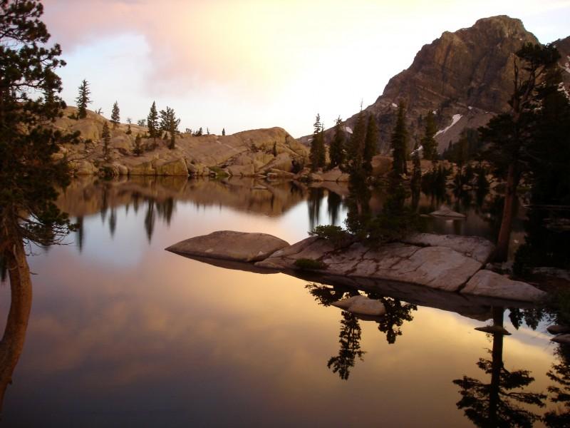
The golden hour in Evolution Basin (Photo 2005)
Continuing south on the JMT we will finally arrive at its southern terminus, the summit of Mount Whitney. The summit of Whitney is also the eastern terminus of a east-west trail called the High Sierra Trail (HST). We’ll follow this trail from Whitney’s summit through the Kern River Gorge and back west and north towards Road’s End in King’s Canyon. We’ve thrown in some cross-country variations around Lion Lake and down through Cloud Canyon to ease us into the next phase of our journey.
Road’s End marks the end of the mostly on trail portion of our hike. At this point we will have covered about 350 trail miles and we will be well trail hardened for the challenge of the SHR ahead of us.
The SHR takes us back north, almost always staying above tree line and usually staying off the trails. The terrain is rugged and alpine. The SHR has been called the most challenging and rewarding hike in the lower 48 more than once. The biggest challenges on the route are talus hiking, steep passes and the route finding required to navigate. Talus fields are areas of large, rocky blocks that cover the high basins, deposited there by rock fall over the millennia. Walking on talus is a tedious, athletic endeavor where one sort of hops from block to block. When you get a rhythm going it can be something like fun. But, you must be constantly paying attention as a slip is bound to hurt.
The SHR is famous for traversing numerous high passes. These passes have no trails and can be steep in their lofty upper reaches (up to 13,000+ ft.). One must climb and descend carefully because the passes also tend to be covered in talus that can be loose and ready to slip down the slope as you hike.
In order to reach these challenges one must navigate with some degree of precision. There is rarely a trail on the SHR so you need to use a map, GPS, compass and a large dose of visual reckoning to choose safe, efficient routes over the terrain.
The reward for taking on this daunting path north will be some of the most beautiful, remote and fabled basins in the Range of Light. The places the SHR will take us are the absolute cream of the High Sierra. The seldom visited, hidden gems of a great range.
On our way north from Road’s End we will pass through Lake Basin, Dusty Basin and Ionian Basin (on a extension of the SHR) on our way to the Muir Trail Ranch. The Muir Trail Ranch is an inholding in the John Muir Wilderness and quite an amazing place, complete with more hot springs to soak our trail worn bodies.
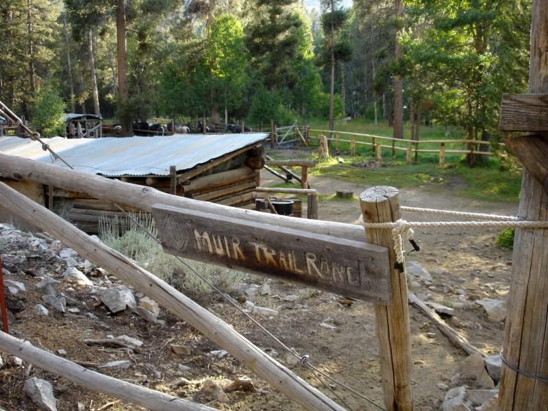
Muir Trail Ranch (Photo 2005)
From Muir Trail it is north again over Snow Tongue Pass, through Humphrey’s Basin, Bear Lakes Basin and the Recess Lakes before eventually wending our way back to Devils Postpile and our sixth resupply.
Ever north, we will make our way cross-country through the beautiful Minarets, along the seldom-traveled west side of the Ritter Range and back into the Yosemite Wilderness. Finally, we will return to Tuolumne Meadows and our last resupply.
North of Tuolumne Meadows we’ll head into the Twenty Lakes Wilderness, over Sky Pilot Col and then back into the Hinterlands one last time. We’ll pass by Solider Lake over Stanton Pass and then finally exit the route by crossing east over the head of Matterhorn Canyon down to Mono Village at Twin lakes.
Sky Pilot Col in the upper right (Photo 2013)
Here’s a summary of our itinerary:
June 14th – Start at Crabtree Meadows
June 20th – Tuolumne Meadows
June 26th – Vermillion Valley Resort
July 4th – Independence
July 15th – Road’s End
July 24th – Muir Trail Ranch
July 31st – Red’s Meadow
August 6th – Tuolumne Meadows
August 10th – End at Mono Village (Twin Lakes)
Woah, what an adventure!